Geology
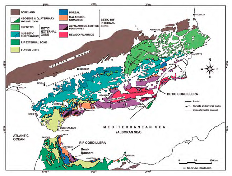
The Granada Geopark is located in the central sector of the Baetic Cordillera (see map), which occupies the south and south-east of the Iberian Peninsula along some 600 km by approximately 200 km wide. The Baetic Cordillera may be divided into several geological domains, such as the Baetic External Zone and the Baetic Internal Zone (this latter also known, including other sub-domains, as the Alborán Domain). Several Neogene basins formed in these domains, including the Guadix-Baza basin, to which the bulk of the Granada Geopark territory belongs. All these domains are represented in the Granada Geopark, but the main one is the Neogene basin of Guadix-Baza, which presents an exceptional thickness of continental sediments from the Quaternary period (several hundreds meters).
The Quaternary is the geological period of the history of the Earth thats covers the last two and a half million years of evolution of the planet and life on it (from 2.58 million years ago to the present).
The Quaternary, with its sediments, fossils and spectacular modeling, is the main protagonist of the Granada Geopark. But the Granada Geopark also tells us of stories older than the Quaternary, thanks to the Mesozoic and tertiary rocks. These rocks do not only appear in the mountains that shape the edge of the Geopark, but, thanks to the engagement of the valleys, they have emerged just below the quaternary sediments in the central part of the Geopark, giving us un excepcional three-dimensional view of the basement that houses and that provided the quaternary sediments.
Delimitation of the Granada Geopark
The territory proposed as a Geopark includes the current river valleys generated during the Quaternary in the North of the Province of Granada, as well as much of the Guadix-Baza Basin and part of the mountains that delimit it, coinciding with the administrative limits from the regions of Guadix, Baza and Huéscar (except its natural and national parks).
The valleys in the North of Granada, main protagonists of our Geopark and actually draining to the Atlantic Ocean, have been created by river erosion in the last half million years. Prior to their formation and for approximately 5 million years, most of the territory was formed by a large river system without exit to the sea and drained its waters into a large lake.
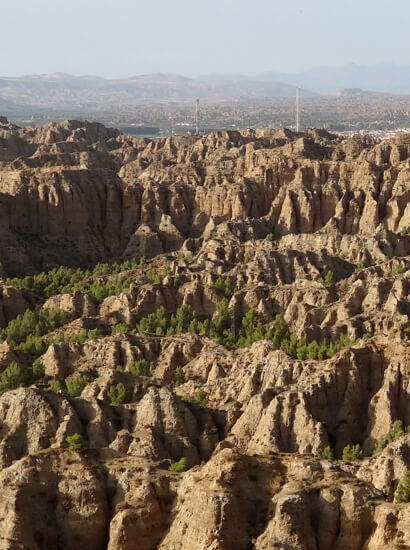
Erosion has generated a landscape characterized by thousands of gullies that reveal rocks:
- of the Mesozoic (Triassic, Jurassic y Cretaceous) and Cenozoic
- of the Cenozoic marine fill (basically Late Miocene)
- of the endorheic continental fill of the Piocene and the Pleistocene
(Early Pleistocene and part of Middle Pleistocene).
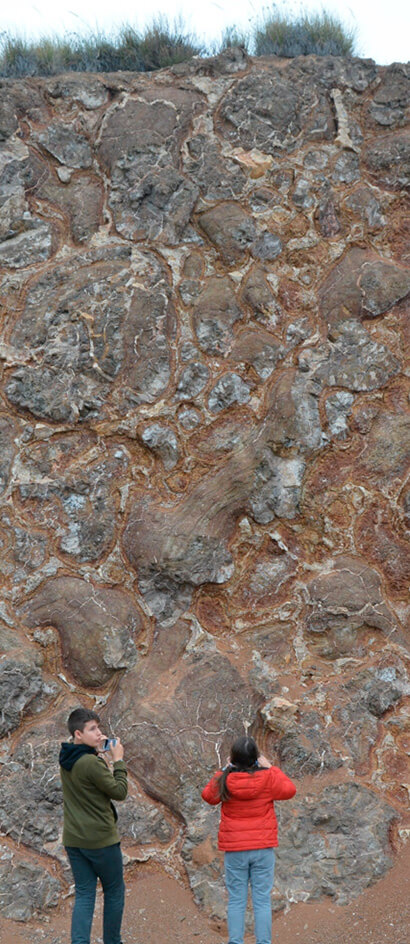
Technical aspects
The technical aspects of the territory of Granada Geopark can be summarized in:
- Geostructural unit: Intramontane depression in one of the sectors with the greatest average altitude in the entire Iberian Peninsula
- Geological periods represented: Mesozoic (Trias- sic, Jurassic and Cretaceous; in basement and insel- bergs); Cenozoic (Palaeogene and Neogene, with marine Miocene and continental Pliocene; Conti- nental Quaternary with endorheic and exorheic units; 50 GEODE-IGME geological age groups).
- Rocks represented: the entire range of sedimentary rocks, both detrital and chemical. (70 sets of litho- logical units, GEODE-IGME). Detrital rocks (conglo- merates, sands and clays) occupy 75% of the surface of the territory under consideration.
- Current morphogenetic systems: the denudative system predominates, in terms of area, with both the fluvial system and the structural-denudative system being represented. Karstic-denudative sys- tems are also to be found. Anthropic forms are res- tricted to urban areas and two reservoirs (Francisco Abellán and Negratín).
- Geomorphological units: the badlands are predo- minant in terms of surface area and vertical deve- lopment. It is the most singular and extensive unit of the area. The fluvial terraces of the main valleys and current riverbeds, floodplains and watercour- ses should also be mentioned.
- Edaphological units of the dominant soils
- Majority hydric regime of the watercourses: seasonal.
- Majority hydraulic regime of the watercourses: torrential.
- Presence of salt flats: Barchel salt flats.
- Inherited desertification: more than 50% of the surface area of the territory.
