Badlands of Marchal (piping)

marchal 1 - Badlands of Marchal (piping) - Geoparque de Granada
Sites of Geological Interest

Badlands of Marchal (piping)

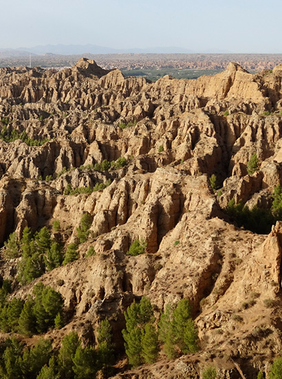
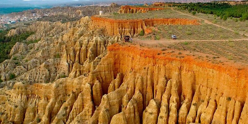
The hillside discovered by the Alhama river inlet, located behind the village of Marchal, represents a typical landscape of badlands in the surroundings of the Guadix and Baza basins.

The gullies have been formed in easily erodible materials due to the erosive action of the runoff water that is concentrated during rainy periods. The process replay allows the dismantling of the slopes at the same time as the retreat of the cliff. This, sometimes, allows the development of very spectacular piping fronts.

Information

Location info

  • Municipio: Marchal
  • Superficie: 35 ha
  • Periodo: Quaternary (middle Pleistocene – actually)
Coordinates: 37.492885, -3.046238
marchal 800x400 - Badlands of Marchal (piping) - Geoparque de Granada

En DIPUTACIÓN DE GRANADA utilizamos cookies propias y de terceros que permiten al usuario la navegación a través de una página web (técnicas), para el seguimiento y análisis estadístico del comportamiento de los usuarios (analíticas). Si acepta este aviso consideraremos que acepta su uso. Puede obtener más información, o bien conocer cómo cambiar la configuración, en nuestra Política de cookies.

Privacy Settings saved!
Configuración de Privacidad

These cookies are necessary for the website to function and cannot be switched off in our systems.

In order to use this website we use the following technically required cookies
  • pll_language
  • wordpress_gdpr_allowed_services
  • wordpress_gdpr_cookies_allowed
  • wordpress_gdpr_cookies_declined

Decline all Services
Accept all Services
Configuración de privacidad
Abrir chat